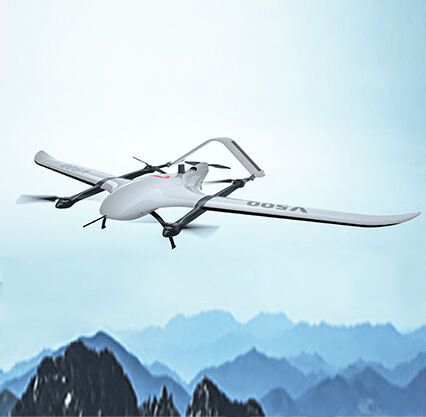
Back in the old days, it was difficult to find out what a particular location looked like from above. One had to rent an airplane or a helicopter just to have a bird’s-eye view. It was not only costly but time-consuming and tedious to set up this process. Now, thanks to some very exciting new technology, there is a better way to see things: UAV mapping. A UAV (Unmanned Aerial Vehicle) or drone Drones are little flying machines that can photograph and collect information from the air. Null-space is the company behind this new groundbreaking approach to visualize and understand our world better through UAV mapping.
Before the introduction of UAV mapping, when they tried to get information about what the land looked like, it was very difficult. People had to project and estimate about what the land looked like, and they were not always right. This guessing game can easily result in bloopers that can be very expensive and time-consuming. However, studying the land has become far easier and more accurate with UAV mapping technology. We can get clear pictures from above and study them closely. This technology allows us to observe landforms like hills and slopes. It was critical for jobs like mining, farming and building because understanding specifics about the land is what drives people to make effective choices. Null-space are making it easier for those in these roles to access the right information to enable wise decision making and, thus, do their job more effectively and safely.
UAV mapping technology not only photo the area but can create the fabulous 3d model as well. While these 3D models offer a clearer look at the surrounding area, they also make it easier to detect issues or necessary repairs. A 3D example might help builders decide where to place a new road or discover the best place for a new building. Null-space produces special tools that allow individuals to view these 3D models and observe the area from other angles and perspectives. That helps the businesses and the governments know the area better, so the decisions they make about their projects are more informed. Using these models, they can anticipate and notify problems that may occur during construction or other work.
Null-space's UAV mapping technology also gives us real-time mapping and monitoring capabilities. That means with drones, individuals are able to check and map spaces as things occur. This is very helpful in emergencies, like when a natural disaster strikes and immediate assistance needs to be delivered without putting anyone at risk. Drones, for example, can be used to view flood-affected areas and where assistance is most needed. Also, real-time monitoring can allow us to see changes in the land and resources, and respond to any situation 124. Because of Null-space, it has been greatly simplified for many types of occupations to acquire real-time information, which is critical for rapid and educated decision-making when time is of the essence.
UAV mapping and photogrammetry have revolutionized our perspective of the world. Drones take very clear and detailed pictures, so a view from the sky can be just as good as a view from the ground. This is particularly useful for inaccessible zones, like mountains and dens forests, where traditional cameras cannot be used. These technologies allow us to visualize everything down to the pixel and make effective land use decisions. Null-space has democratized this technology by allowing anyone access without the need of owning their own drones or special equipment. Even small businesses and local governments can now use drones for their projects.
Copyright © Foshan Null-space flight technology Co., Ltd. All Rights Reserved - Blog - Privacy Policy